Leaf cell pattern or urban Street layout - Maple leaf blight
Submitted by Jeff Buster on Fri, 11/12/2010 - 20:36.
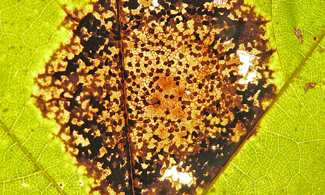
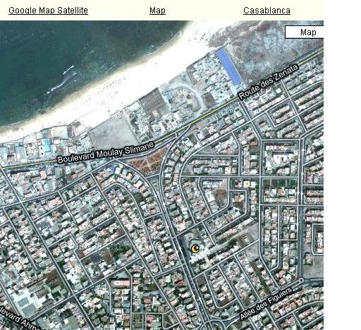
If this were an aerial mapping image, there would be streets and blocks and main through-a-fares. Google Earth for Shaker Heights or Casablanca, Morocco.
Over the last few years, since reading some of Steven Wolfram’s New Kind of Science stuff, I have begun to look at many things in nature with the eye of a computer. If our brains were bigger, and our processors faster, what would be the connections we would make?
Is it purely coincidence that the cells in the maple leaf, and the black cells of the Maple Leaf Tar Spot Rot blight, appear as a aerial road map?
I don’t think so.
( categories: )
|


Jeff...
that, is, so cool. What a wonderful "Fall" photo!